(207) 762-2010 kimberly.sebold@maine.edu
  • Facebook
  • Facebook
Aroostook County History
  • Home
  • Cemetery Maps
  • StoryMaps
  • Resources
  • Towns of Aroostook
    • Caribou, Maine
    • Easton, Maine
    • Fort Fairfield, Maine
    • Limestone, Maine
    • Mapleton, Maine
    • Mars Hill, Maine
    • Maysville, Maine
    • Presque Isle, Maine
      • Yesterday & Today
    • Washburn, Maine
    • Woodland, Maine
  • Events
  • News
  • About
  • Contact
Select Page

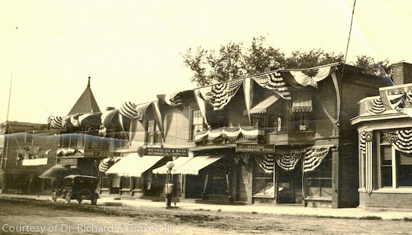
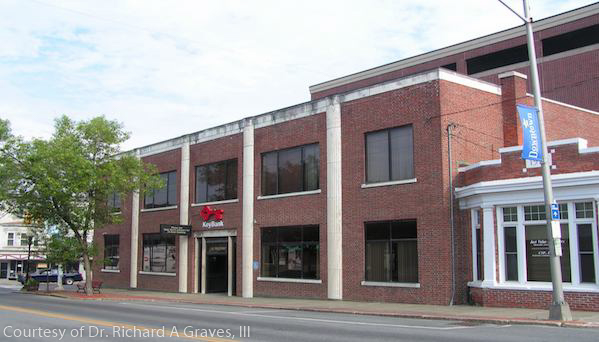
State Street

Presque Isle Yesterday & Today

Bolton Block in 1920. The building was constructed in 1891 and was condemned by the 1938 and 1943. The

Sepia-toned historical photograph of a row of two-story storefronts in downtown Presque Isle, Maine, decorated with patriotic bunting and striped awnings, with early automobiles parked along an unpaved street and pedestrians visible on the sidewalk.Color photograph of a two-story red-brick commercial building in Presque Isle, Maine, with large rectangular windows, a central entrance, and adjacent storefronts along a downtown street with trees and sidewalks.

Caribou Chapman church Easton folklore Fort Fairfield Green Ridge Grendell Irish Main Street Mapleton Mars Hill Mi'kmaq Micmac Mount Shiloh pine Pine Tree Presque Isle Riverside Saint Mary St. Denis St. Mary State Street women's history World War I

  • About
  • News
  • Contact
  • Terms of Use
Designed by the Wicked Good Life | ©Mouse Island Creatives