(207) 762-2010 kimberly.sebold@maine.edu
  • Facebook
  • Facebook
Aroostook County History
  • Home
  • Cemetery Maps
  • StoryMaps
  • Resources
  • Towns of Aroostook
    • Caribou, Maine
    • Easton, Maine
    • Fort Fairfield, Maine
    • Limestone, Maine
    • Mapleton, Maine
    • Mars Hill, Maine
    • Maysville, Maine
    • Presque Isle, Maine
      • Yesterday & Today
    • Washburn, Maine
    • Woodland, Maine
  • Events
  • News
  • About
  • Contact
Select Page

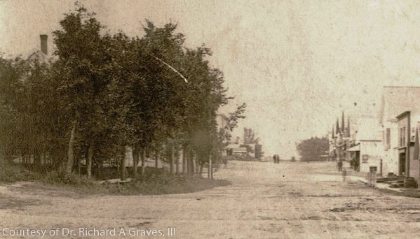
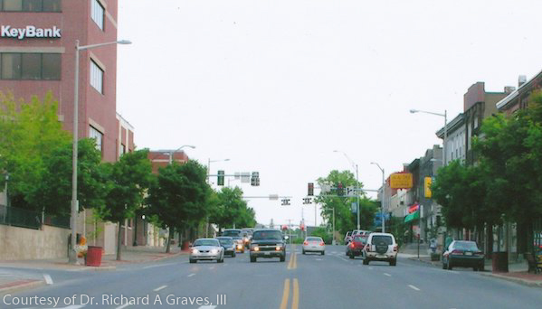
Main Street

Presque Isle Yesterday & Today

This photo Circa 1880 is the oldest known photograph and view of Presque Isle.


Sepia-toned historic photograph of early downtown Presque Isle, Maine, showing a wide dirt street lined with trees on the left and wooden commercial buildings on the right, with sparse development, utility poles, and no paved roadway, reflecting an early 20th-century streetscape.Color photograph of downtown Presque Isle, Maine, looking down a multi-lane street with modern traffic lights, cars traveling in both directions, brick commercial buildings, storefront signs, and tree-lined sidewalks on either side.

Caribou Chapman church Easton folklore Fort Fairfield Green Ridge Grendell Irish Main Street Mapleton Mars Hill Mi'kmaq Micmac Mount Shiloh pine Pine Tree Presque Isle Riverside Saint Mary St. Denis St. Mary State Street women's history World War I

  • About
  • News
  • Contact
  • Terms of Use
Designed by the Wicked Good Life | ©Mouse Island Creatives